- Data
- Videos
-
Publications & Research
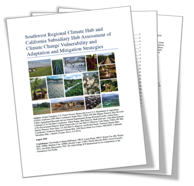
Southwest Regional Climate Hub and California Subsidiary Hub Assessment of Climate Change Vulnerability and Adaptation and Mitigation Strategies -
Education
- Water Conservation Data Jam - Curriculum for 6th-12th Grade Students
- Climate Change and Wildfire – Curriculum Unit for 9-12 Grade Students
- Climate Change and the Carbon Cycle – Curriculum Unit for 9-12 Grade Students
- Where's Our Water? Water Conservation in the Southwest - Lesson for 6-8 Grade Students
- Climate Change and the Water Cycle - 10-Hour Curriculum Unit for 6-12 Grade Students
- The Effects of Climate Change on Agricultural Systems - 5-Hour Curriculum Unit for 6-12 Grade Students
- Cambio climatico y el ciclo del agua
- Webinars and Online Courses
- Websites
- News & Events
- About Us
- RMA
Tools & Apps
|
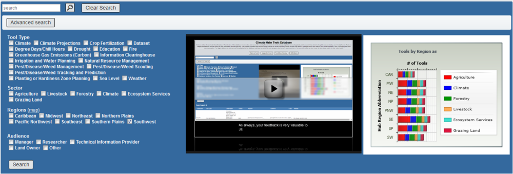
A searchable inventory of tools to assist extension, consultants, land managers, and researchers with climate change adaptation on working lands
|
- COMET-FARM Farm and Ranch - carbon and greenhouse gas accounting system
- US Drought Portal - drought maps and data
- National Drought Mitigation Center - Drought Management Database
- National Drought Mitigation Center Vegetation Drought Response Index - VegDRI is a bi-weekly depiction of vegetation stress across the United States
- Climate Assessment for the Southwest (CLIMAS) - drought forecasts and maps for the southwest
- US Forest Service Climate Change resource center - climate change and carbon tools
- Community Collaborative Rain, Hail & Snow Network (CoCoRaHS) - national and state maps of daily precipitation by date (current and historical)
- National Oceanic and Atmospheric Administration (NOAA) - has an abundance of information about our ever-changing environment including climate monitoring, daily weather forecasts, severe storm warnings
- National Climatic Data Center (NCDC) archives data and makes climatological research data and services freely available worldwide. Records in the archive range from paleoclimatology data to centuries-old journals to data less than an hour old. The Center's mission is to preserve these data and make them available to the public, business, industry, government, and researchers.
- Drought Termination and Amelioration - maps of precipitation required to end or ameliorate drought across the Contiguous US, and the probability of receiving that precipitation
- Climate at a Glance - Comparisons of meteorological local, state, regional, national, and global data in historical perspective to determine trends
- statistical weather and climate information
- tools for use with climate research, analysis, and error-reporting
- National Oceanographic Data Center archives data and makes oceanographic research data and satellite/observational data freely available
- Climate.gov delivers scientific data and information about climate in order to promote public understanding of climate science, to provide climate-related support to the private sector, and to serve people making climate-related decisions with tools and resources that help them answer specific questions.
- Climate Prediction Center GIS Portal routinely delivers products that include operational predictions of climate variability, real-time global climate monitoring products, and assessments of the origins of climate anomalies. The retrospective analyses and forecast products span time scales from a week to a year and cover the land, the ocean, and the atmosphere, extending into the stratosphere.
- Climate Prediction Center outlook maps, graphs and tables - monthly to seasonal climate outlook maps; extended range outlook maps with probabilities of temperature and precipitation, excessive heat and wind chill index; special outlooks like degree day, drought and soil moisture, daily UV radiation index
- National Climatic Data Center (NCDC) archives data and makes climatological research data and services freely available worldwide. Records in the archive range from paleoclimatology data to centuries-old journals to data less than an hour old. The Center's mission is to preserve these data and make them available to the public, business, industry, government, and researchers.
- Global Change Information System (GCIS) is a web-based resource for traceable, sound global change data, information, and products. Designed for use by scientists, decision makers, and the public, the GCIS provides coordinated links to a select group of information products produced, maintained, and disseminated by government agencies and organizations.
- Western Regional Climate Center - climate summaries, maps, extremes, and much more.
- Intermountain West Climate Dashboard provides climate graphics that are automatically updated as often as the original providers post them on their respective websites (the update frequency is listed under each graphic).
- USGS Water Data Discovery actively promotes the use of reliable, impartial, and timely information to minimize loss of life and property from water-related natural hazards; manage groundwater and surface-water resources for domestic, agricultural, commercial, industrial, recreational, and ecological uses; protect and water resources for human health, aquatic health, and environmental quality
- Community Environmental Monitoring Program (CEMP) is a network of 24 monitoring stations located in communities surrounding and downwind of the Nevada National Security Site (NNSS) that monitor the airborne and groundwater environments for manmade radioactivity that could result from NNSS activities
- U.S. Climate Data 15-day weather forecasts, current weather, alerts, radar, and maps; developed by Your Weather Service
- US Environmental Protection Agency Climate Change Research methods, models, tools, and databases